Ville de Mitcham

Un article de Wikipédia, l'encyclopédie libre.

Ville de Mitcham
Ville de Mitcham
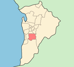
Localisation de la zone d'administration locale.
Administration
Pays Drapeau de l'Australie Australie
État ou Territoire Australie-Méridionale
Région Adélaïde
Nom du Conseil Conseil de la Ville de Mitcham
Siège du Conseil Torrens Park
Maire Ivan Brooks
Démographie
Population 61 853 hab. (2006)
Densité 818 hab./km2
Géographie
Coordonnées 35° 01′ sud, 138° 38′ est
Superficie 7 560 ha = 75,6 km2
Liens
Site web http://www.mitcham.sa.gov.au/

La Ville de Mitcham (City of Mitcham) est une zone d'administration locale au sud du centre ville d'Adélaïde en Australie-Méridionale en Australie.

Elle accueille l'université Flinders.

Quartiers[modifier | modifier le code]

  • Bedford Park Code Postal:5042
  • Belair CP:5052
  • Bellevue Heights CP:5050
  • Blackwood CP:5051
  • Brown Hill Creek CP:5062
  • Clapham CP:5062
  • Clarence Gardens CP:5039
  • Colonel Light Gardens CP:5041
  • Coromandel Valley CP:5051
  • Crafers West CP:5152
  • Craigburn Farm CP:5051
  • Cumberland Park CP:5041
  • Daw Park CP:5041
  • Eden Hills CP:5050
  • Glenalta CP:5052
  • Hawthorn CP:5062
  • Hawthorndene CP:5051
  • Kingswood CP:5062
  • Leawood Gardens CP:5150
  • Lower Mitcham CP:5062
  • Lynton CP:5062
  • Melrose Park CP:5039
  • Mitcham CP:5062
  • Netherby CP:5062
  • Panorama CP:5041
  • Pasadena CP:5042
  • Springfield CP:5062
  • St. Marys CP:5042
  • Torrens Park CP:5062
  • Upper Sturt CP:5156
  • Urrbrae CP:5064
  • Westbourne Park CP:5041

Notes et références[modifier | modifier le code]